


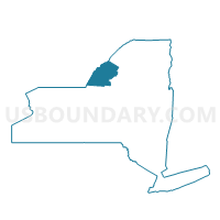
Voting District 180002, Jefferson County, New York
About
Outline

Summary
| Unique Area Identifier | 627517 |
| Name | Voting District 180002 |
| County | Jefferson County |
| State | New York |
| Area (square miles) | 9.35 |
| Land Area (square miles) | 9.19 |
| Water Area (square miles) | 0.16 |
| % of Land Area | 98.33 |
| % of Water Area | 1.67 |
| Latitude of the Internal Point | 44.00068280 |
| Longtitude of the Internal Point | -75.78291300 |
Maps


Graphs
Select a template below for downloading or customizing gragh for Voting District 180002, Jefferson County, New York


Neighbors
Neighoring Voting District (by Name) Neighboring Voting District on the Map
- Voting District 060001, Jefferson County, NY
- Voting District 060003, Jefferson County, NY
- Voting District 110007 110008, Jefferson County, NY
- Voting District 110010, Jefferson County, NY
- Voting District 180001, Jefferson County, NY
- Voting District 180003, Jefferson County, NY
- Voting District 200004, Jefferson County, NY
Top 10 Neighboring County Subdivision (by Population) Neighboring County Subdivision on the Map
- Le Ray town, Jefferson County, NY (21,782)
- Champion town, Jefferson County, NY (4,494)
- Watertown town, Jefferson County, NY (4,470)
- Rutland town, Jefferson County, NY (3,060)
Top 10 Neighboring Place (by Population) Neighboring Place on the Map
- Fort Drum CDP, NY (12,955)
- Black River village, NY (1,348)
- Great Bend CDP, NY (843)
- Felts Mills CDP, NY (372)
Top 10 Neighboring Unified School District (by Population) Neighboring Unified School District on the Map
- Watertown City School District, NY (30,934)
- Carthage Central School District, NY (14,592)
- School District Not Defined, NY (13,644)